地図 - パース (西オーストラリア州) (Perth)

パース (Perth)
パース(Perth, オーストラリア英語発音: )は、オーストラリア連邦の西オーストラリア州の州都であり、同州の最大都市である.

地方自治体(シャイア)としてのシティ・オブ・パースは人口は27,762人程度(2018年)だが、パース都市圏の人口は約209万人(2019年)にも及ぶ. 西オーストラリアを代表する大都市である.
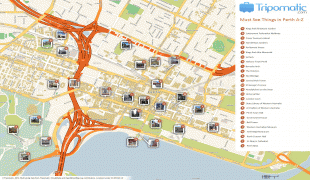
 
地図 - パース (Perth)
地図
Google Earth - 地図 - パース (西オーストラリア州)
Google Earth
ビング - 地図 - パース (西オーストラリア州)
ビング
ノキア - 地図 - パース (西オーストラリア州)
ノキア
オープンストリートマップ - 地図 - パース (西オーストラリア州)
オープンストリートマップ
zzr_map_1.jpg
2459x3274
members.westnet.com....
Perth_Railway_map.pn...
2188x2797
upload.wikimedia.org
Perth_tram_map_1920....
2000x2178
upload.wikimedia.org
communitycouncils.jp...
2335x1571
www.cpkcc.org.uk
Perth_and_Kinross_UK...
2002x1753
upload.wikimedia.org
perth-attractions-ma...
2105x1488
cdn-locations.tripom...
perth-map1.jpg
1427x1374
petabreerule.files.w...
Perth-City-Map.gif
2054x915
mappery.com
Perth-City-Map.gif
2054x915
www.mappery.com
Perth-Street-Map.jpg
1476x968
mappery.com
Perth-Street-Map.jpg
1476x968
www.mappery.com
Map+of+Perth.png
1456x870
4.bp.blogspot.com
perth_city_delivery_...
1235x717
www.officemilksuppli...
perth_city_delivery_...
1235x717
officemilksupplies.c...
MapPerth.jpg
757x793
www.jvanderw.nl
greater-perth-surrou...
730x817
www.sydney-australia...
perth-map.jpg
700x726
www.planetware.com
Perth-map.jpg
820x607
www.spiritland.net
Perth-Map.jpg
642x677
airlinesalert.com
perth-map4.jpg
800x483
www.justmaps.org
国 - オーストラリア
オーストラリアの国旗
オーストラリア連邦(オーストラリアれんぽう、) 、通称オーストラリア() は、オセアニアに位置し、オーストラリア大陸本土、タスマニア島及び多数の小島から成る連邦立憲君主制国家. 首都はキャンベラ. 最大の都市はシドニー.

イギリス連邦加盟国であり、英連邦王国の一国となっている. 日本での略称は豪州(ごうしゅう)である. 総面積は世界第6位である. 近隣諸国としては、北にパプアニューギニア・インドネシア・東ティモール、北東にソロモン諸島・バヌアツ、東はトンガ・ニューカレドニア・フィジー、南東2,000km先にニュージーランドがある.
通貨 / 言語  
ISO 通貨 シンボル 有効数字
AUD オーストラリア・ドル (Australian dollar) $ 2
ISO 言語
EN 英語 (English language)
Neighbourhood - 国  
行政区画
都市, 村落,...